|
Quadricentennial Challenge
 Catskills Live! Trails & Wilderness Association issues a challenge to all — venture forth and seek all 15 Quadricentennial Challenge geocaches. Go to many great places throughout Ulster County — visit the shores of the Hudson, feel the cool air in an historic cement mine,
enjoy our small parks, ride on our rail trails, summit two Catskill peaks, and savor the breath-taking view from Gertrude's Nose in Minnewaska State Park Preserve. Bask in our county's treasures with family and friends, exercise your body, and build lasting memories. Specially minted commemorative
Quadricentennial geocoins are being released from Challenge geocaches in celebration of the 400th anniversary of the exploration of the Hudson by Henry Hudson. All 15 Challenge caches will be available this summer. Funding for the Challenge was provided by Ulster County and the Hudson River Valley Greenway.
Catskills Live! Trails & Wilderness Association issues a challenge to all — venture forth and seek all 15 Quadricentennial Challenge geocaches. Go to many great places throughout Ulster County — visit the shores of the Hudson, feel the cool air in an historic cement mine,
enjoy our small parks, ride on our rail trails, summit two Catskill peaks, and savor the breath-taking view from Gertrude's Nose in Minnewaska State Park Preserve. Bask in our county's treasures with family and friends, exercise your body, and build lasting memories. Specially minted commemorative
Quadricentennial geocoins are being released from Challenge geocaches in celebration of the 400th anniversary of the exploration of the Hudson by Henry Hudson. All 15 Challenge caches will be available this summer. Funding for the Challenge was provided by Ulster County and the Hudson River Valley Greenway.
D & H Canal Heritage Corridor
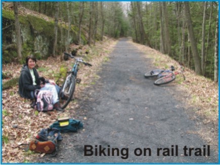
The Hurley Rail Trail Park is part of the longer D & H Canal Heritage Corridor. This geocache is on a 3.1 mile segment of rail trail used by the public for walking, jogging, bike riding, and cross country skiing. With much of its length wooded, it provides a safe and peaceful setting for outdoor
exercise.
Beavers and Wetlands
 With the recognition of New York State's vast resources stemming from Henry Hudson's 1609 voyage, beaver trapping followed to supply the market with warm coats and fashionable men's top hats. The demand for beaver fur was so great, they were nearly hunted to extinction. With attention diverted by the gold
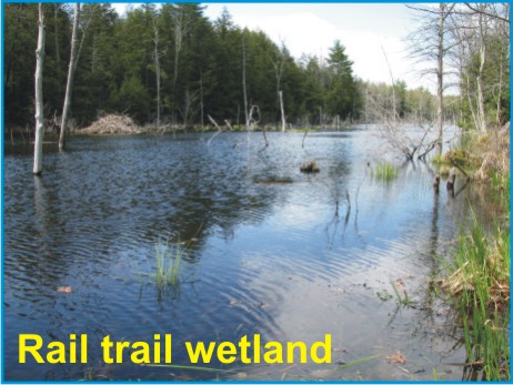
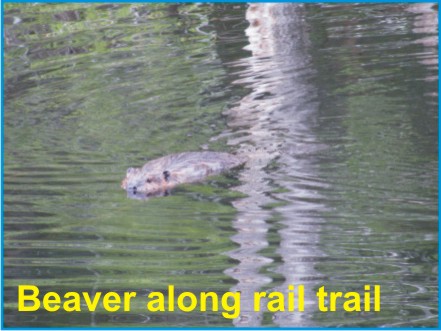
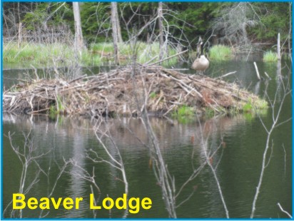
rush, beavers recovered. It's easy to see beavers and their lodges in the elongate wetland along The Rail Trail Park. The wetland is teaming with turtles, great blue herons, song birds, wetland plant species and much more. It is the beavers that have helped form and expand the wetland by building dams along a very low gradient section of a small stream. Beavers are considered a keystone species because their activities create important habitat for themselves, reptiles, amphibians, fish, and waterfowl. At first glance, the beavers we see today seem as if they have always been here, but this is not the case.
With the recognition of New York State's vast resources stemming from Henry Hudson's 1609 voyage, beaver trapping followed to supply the market with warm coats and fashionable men's top hats. The demand for beaver fur was so great, they were nearly hunted to extinction. With attention diverted by the gold
rush, beavers recovered. It's easy to see beavers and their lodges in the elongate wetland along The Rail Trail Park. The wetland is teaming with turtles, great blue herons, song birds, wetland plant species and much more. It is the beavers that have helped form and expand the wetland by building dams along a very low gradient section of a small stream. Beavers are considered a keystone species because their activities create important habitat for themselves, reptiles, amphibians, fish, and waterfowl. At first glance, the beavers we see today seem as if they have always been here, but this is not the case.
Has this picture been the same over the last 14,000 years since the last glacier left the Catskill Mountain area? When did beavers colonize our area? Until the publication of this geocache description, the only ice age mammal that evidence had proven lived here was the elephant-like mastodont. Like Henry Hudson's voyage into the unknown, let our rail trail venture serve as a stepping stone — mentally bridging between today's beavers and those of the Pleistocene epoch.
 The treasure we seek along our mental trail takes us some 13 miles to the north-northwest near Willow, where we find wetlands like those along The Hurley Rail Trail Park. Here, stream erosion has exposed a high bank with beaver-chewed logs sticking out of it. Above these logs there are about six feet of flat-lying fine sediment layers. Below the beaver-chewed logs, there is a thick deposit of stream-rounded pebbles with little sediment. Something most unusual caused a marked change from an active, aggressively flowing, stream environment that left behind the pebble deposit to a large swampy environment with the slow accumulation of fine sediments. The answer lies in the beaver-chewed logs. Radiocarbon dating of one of the logs has revealed an age of just slightly over 10,000 years. Thus, just as in the wetland setting now seen along the rail trail, beavers in the nearby Willow area 10,000 years ago must have manipulated their environment by damming up a low gradient stream reach.
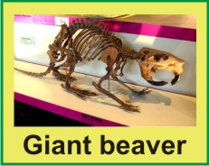
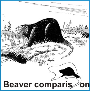 While both giant and modern beavers did coexist during the last part of the ice age, it is possible that the beavers that chewed the logs were not the beavers we see today. They may have been giant beavers, measuring 6 to 8 feet in length and weighing up to 500 pounds (see skeleton photo: Canadian Museum of Nature). A modern beaver weighs about 65 pounds. With the exception of their tails being narrower, their hind legs being somewhat shorter, and their broad ridged incisors reaching up to 6 inches in length, giant beavers were in most ways physically similar to the beavers of today.
 They were the largest known rodent in North America during the last ice age, the size of a modern black bear. They became extinct around 9,000 years ago. As you pass the wetland along the rail trail, envision bear-sized beavers swimming — occasionally glancing upward at a bellowing mastodont drinking nearby.
The Cache
Access to the cache is along the rail trail. The cache is a 2-liter cylindrical poly bottle hidden close to the rail trail.
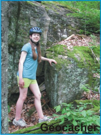
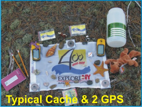 Nearby, there is a low bedrock cliff comprised of the Esopus shale that whispers of deposition in a deep ocean environment with limited life. The cache is filled with kid-friendly items and, initially, three NYS Quadricentennial Challenge geocoins designed to travel throughout the world. (Permission for placement of this cache was granted jointly by Gary Bellows, Supervisor of the Town of Hurley, and Brooke Pickering Cole, Supervisor of the Town of Marbletown.)
Parking
 Parking is available in two locations. One is in a lot off Route 209 and the other is in a small parking area off Marcott Road, both south of Kingston, New York. The Route 209 parking lot is 1.2 miles north of the cache, while the Marcott Road parking area is 2.0 miles south of the cache.
Care should be taken when proceeding northward along the rail trail from the Marcott Road parking area because it passes alongside the elongate wetland described above where geocachers risk encountering giant beavers and mastodonts!
|